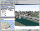
Real time fully interactive Terrain Visualization for Civil Planning!
| Do you want to evaluate multiple bridge designs by soliciting public opinions online? It's possible using Skyline's various tools. Telecommunication engineers and civil planners can preview and build amazingly realistic views of projects that are currently in design/review, convey project status to large audiences over the Internet or provide critical team input to the process before breaking ground. |

|
Why use Skyline 3D visualization for Civil Planning?
With its innumerable resources, Skyline's software can ease the development and presentation of any project. Skyline's construct of Paris shows how our software can assist in visualizing large planning projects, but the true power will be found through overlaying your own specific working drawings, GIS layers, and 3D models on the actual terrain. Skyline’s photo realistic 3D worlds can influence public opinion by giving concerned citizens an accurate representation of a proposed projects aesthetic and environmental impact before construction begins.
|
 Se connecter
 Se connecter